Fargo to Theodore Roosevelt National Park. The sites were first come, first serve, so we only stopped at a rest area and gas stations along the way. The landscape changed from extremely flat farmland, to grassy areas with little lakes, and then to hilly cattle grazing land, and then wham, we were suddenly in badlands rock formation. The whole day we were climbing slowly in altitude too. We got to the Park about 3:00 and scored one of the last available sites. Sweet! Then we set up, Jeff got his solar setup hooked up (no electricity or water at this campground) and we relaxed the rest of the night. See photos for the highlights and explanations of how we set things up.
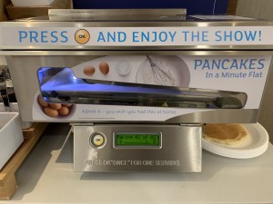
We try to use hotels that have the complimentary breakfasts , but this is the first time we saw this cool pancake maker. 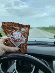
Jeff discovered these pretzels and now we are hooked! Garlic salted pretzels, so yummy! 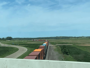
Jeff likes trains. 
Denny Hemlin’s show car. 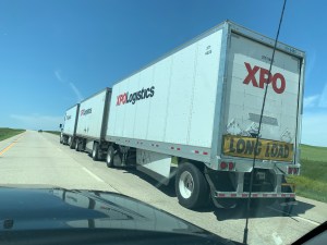
Let’s hear it for the cross country truckers! Hauling two trailers can’t be easy. 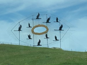
This huge sculpture was at an exit that led to Enchanted Highway, which apparently is a highway with lots of huge sculptures. We didn’t have time to take this, but it looks intriguing! 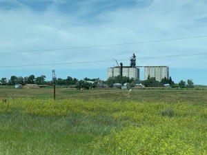
The landscape was sparsely dotted with farms with many grain silos. 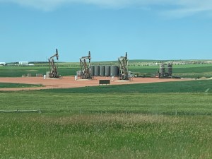
As we moved west, we suddenly started to see oil wells everywhere. 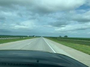
This was our view most of the morning. Extremely flat, farm fields on both sides, highway barely even curved as we drove on I94. 
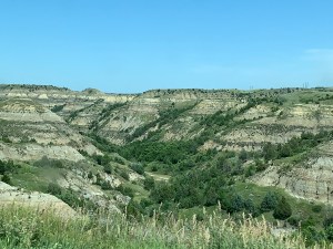
We turned north off of I94 and drove for a while through oil country and then out of nowhere, started to see badlands landscapes. Each ride was more beautiful than the previous one. 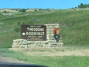
We made it to Theodore Roosevelt NP. There are two units of this park about 1.5 hours away from each other. We chose to go to the north unit on this trip because the camping sites don’t fill as fast and it is less touristy and less crowded than the south unit which is right off I94. 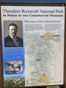
The Elkhorn Ranch is the actual land that Teddy Roosevelt lived and ranched on. During the Great Depression, the federal government bought land from people for $6 and acre as drought, and wind storms made so many farms and ranches fail. All the green squares on this map are pieces of land they purchased. Over the years this parts of this land became the National Park and the rest became federal grasslands and other levels of protected land. 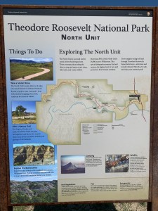
Juniper Campground is near the middle of the north unit. 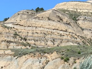
Amy geeks out over rocks. So much geological history in those layers! Cool! 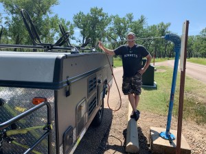
We stopped to fill the water tank. Blue pole means it is the clean potable water, the red pole in the background is for when you clean out the black water tanks (“Shitter’s full!”) as you leave. 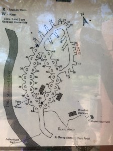
We are on site 47. 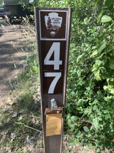
We are on site 47. 
Gotta be smarter than the average bears around here! Though the rangers never mentioned any bear sightings. Buffalo, feral horses, prairie dogs, and Long Horn sheep are the big animals on our hope-to-see list for this park. 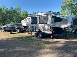
Our setup. Small pull through site, but no one is directly behind us so it feels pretty secluded. 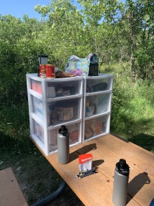
We use a drawer system for all our stuff so we can easily pack it back up in the back of the truck and still access things if we need to during our driving time. One bin has a drawer for plates, cups and disposable utensils, a pots and pan drawer, and a drawer for cooking tools, and reusable silverware (which we use as much as possible). The other bin is the food bin. One drawer for buns, and snacks, one with spices and the basics ingredients for making pancakes, and the top drawer is for extra stuff like batteries and other gadgets that Jeff likes to have on hand. 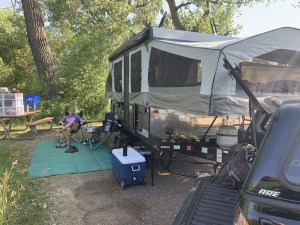
Not a spacious campsite but it felt secluded. We didn’t bring the kids lawn chairs because they never sit in them. And of course they asked for them tonight! 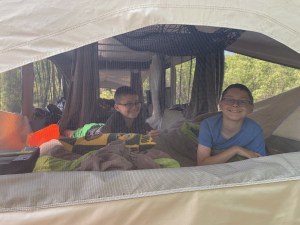
The boys love sleeping in the camper! 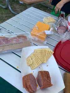
Jeff made chili for the boys for dinner while we feasted on sausage, prosciutto Italian, cheese, and crackers. 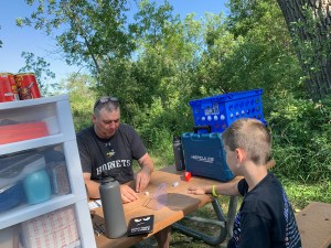
Jeff bought a travel Yahtzee at the Mall, and was in heaven teaching Carson how to play. Carson best him in the first game too! 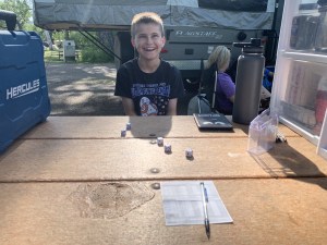
Carson’s face when he wins Yahtzee. 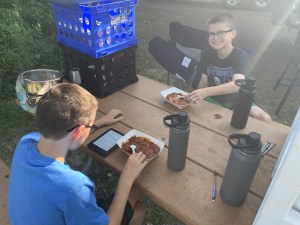
Canned chili for the boys for dinner. 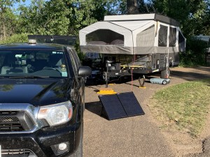
Closer view of the solar panel. 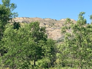
Our view from the back of the campsite. 
A couple campsites were closed off, perhaps due to erosion. There is about a 15 foot drop and it looks like some big trees fell into the water. 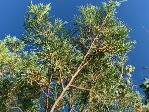
Amy playing with the camera. Does anyone know what kind of tree this is? 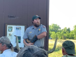
Amy went to the ranger talk and learned about what the CCC and WPA programs did to improve the park and land. 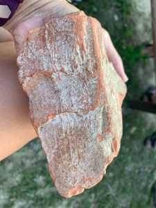
This is clinker rock that was directly above a lignite coal seam, which burns when struck by lightning. When burned this sandstone becomes very hard like a brick, and doesn’t erode as easily. 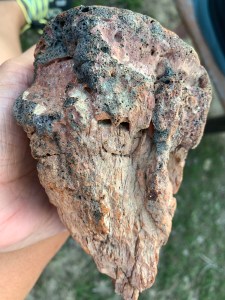
This rock is very porous and very light weight 
Jeff felt an obligation to post the traditional beach shot that all vacationers seem to post. 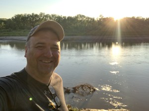
I love Jeff’s sunset selfie! 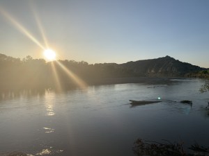
Sunset on the eroded campsite down the path from us. 
10 pm and it is still dusk out.
